Category Archives: Aerial Photos

Aerial photos, photos taken from planes, helicopters, balloons, etc.

Mount St. Elias – the Film

Aerial view of a mountain in the St. Elias Mountain Range, Wrangell-St. Elias National Park and Preserve, Alaska.

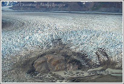
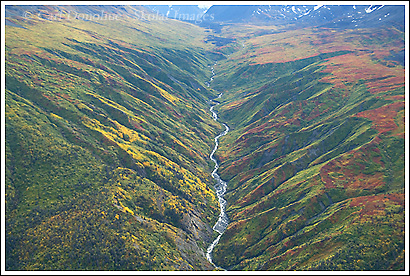
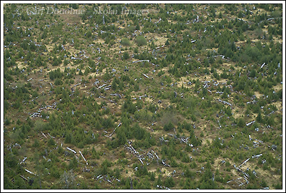
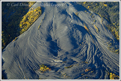
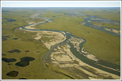
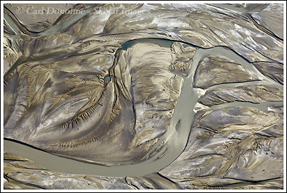
Looking down from a great height at some of the amazing escarpments in the St. Elias Mountain Range, Wrangell-St. Elias National Park and Preserve, Alaska. Click on the image to see a larger version.

Hey Folks,

Have you ever thought about climbing the 2nd highest mountain in the US, the 2nd highest mountain in Canada, the 3rd highest mountain in North America, the mountain with the greatest vertical relief of any mountain in the world so you can ski from top to bottom? From 18 008′ to the sea? If so, this movie’s for you. Mount St. Elias. 2 Austrian mountaineers and an American freeski mountaineer set out to run the “ultimate vertical descent” – 18 000 of skiing from the summit of Mount St. Elias to the sea, to Icy Bay. Pretty amazing stuff to watch, I can’t begin to imagine what that kind of endeavor must be like.

“If you want to achieve something great, you have to risk more than usual – that’s the way it is.” — (Axel Naglich) Continue reading

Name That Mountain: = Mt. Logan, Canada

Mount Logan, Canada.

Hey Folks,

Here’s another in the long line of ‘Name That Mountain’ posts. I’ll give you a hint; it’s huge. Really, really, really big. Bigger than Mt. Blackburn. Bigger than Mt Foraker. Bigger than Mt St. Elias. Quite a massif. The mountain is NOT in Wrangell-St. Elias National Park, but the photo was taken from inside Wrangell-St. Elias National Park.

I’ll be gone as of today (friday, the 18th), and will be back in October. I’ll post more about that trip later .. check back in a week or so for a scheduled post that’s a mustelid .. way cool.

After that, well, we’ll see what the next 2 weeks brings.

Cheers

Carl

Twin Lakes, Wrangell-St. Elias National Park

Windblow snow patterns over frozen Twin Lakes, near the Nabesna Road, Wrangell-St. Elias National Park, Alaska.

Hey Folks,

I must admit; I really like shooting the patterns the windblown snow makes on the ground in the winter. They can be some pretty cool patterns. This frozen lake, covered in over 3′ of snow (deeper in some places, with drifts) was a nice place to wander around on and look for images.

The setting sun faded slowly across the lake, and I chased it’s light from shore to shore as it slipped into the night. Continue reading

Tana Glacier, Wrangell-St. Elias National Park, Alaska

Broken calving ice at the terminus of the Tana Glacier, near the Bagley Icefield, Wrangell-St. Elias National Park, Alaska.

Hey Folks,

Here’s another aerial photo I took, right before we landed at Ross Green Lake. This is the terminus of the Tana Glacier. It used to be possible to hike from Ross Green Lake, east of here (to the left) across the glacier, and around to Iceberg Lake. As you can see from this photo, the Tana Glacier has become an array of crevasses – not something one can easily, or safely, hike across. The route hasn’t been hiked in a few years. I wish I had an opportunity this trip to explore it a little more, and possibly find a new route across. It looked to me, from the air, like it was possible slightly to the north of here, but I can’t say without hiking it first, or at least a good look from the ground – from the air, in a place as vast as this, perspective is everything, and things are often not as they appear to be; the scale is so hard to gauge.

I like the story this photo tells – of the place of ice and water on rock, and how this stuff works. Look at the rock in the foreground, and the debris surrounding it, torn, cracked, splintered and shattered by power of the ice and a little gravity. In the background, you can clearly see a medial moraine, running down between the seam of 2 glaciers that run together off the great Bagley Icefield to create the Tana Glacier.

I did get to hike, one afternoon, down from our camp to the Tana Glacier and walk around it a bit. it’s amazing being on the ice. I’ll post some photos from that hike later.

Cheers

Carl

Fall Color, Wrangell-St. Elias National Park.

fall color near Tana River, Wrangell-St. Elias National Park, Alaska.

Hey Folks,

Here’s a second post for today. I’m trying to see if I’ve fixed a few things that have suddenly been messing with my blog – darn pesky hackers! So here goes:

I just finished a trip to Ross Green Lake, Wrangell-St. Elias National Park – we basecamped near the lake, and spent our days exploring the valley, the nearby Tana Glacier, and photographing the fall colors.

The weather wasn’t the best – a day in the rain on a chunk of ice that’s part of the largest non-polar ice field in the world is a rough gig.

But we did have a good time.

This image is of a small valley that runs down to the Tana River valley, show from the plane as we flew to Ross Green Lake. I hadn’t even landed for our trip and I already got some nice photos. Flying around Wrangell-St. Elias National Park is a real treat, and I’m fortunate that I get to do it as often as I do. It’s simply amazing to view from the air.

Cheers

Carl

Clearcutting, Tongass National Forest photos, Alaska

Clearcuts in the Tongass National Forest, Alaska (aerial photo)

Hey Folks,

One reason I really looked forward to getting down to this area was to see the Tongass National Forest. The Tongass is one of the last great forests remaining in the US, and probably the great temperate rainforest of the world (along with the forests of Pumalin and surrounding area, central Patagonia, Chile). I’ll try to write more on the Tongass as I get time.

What this shows is why the expectation is that someone will soon rename the forest, “Tong National Forest” – as clear-cutting and intensive logging continue to literally tear the ass out of the forest.

This kind of stuff is SO destructive, and heartbreaking to see.

Fortunately, much of the clear-cutting is no longer undertaken, and the older cut areas have started to grow back – but to regenerate an ancient forest and all its glory takes centuries.

Cheers

Carl

Coastal plain photo, Arctic National Wildlife Refuge, Alaska.

Coastal plain, Canning River, Sec 1002, ANWR, Alaska

Hey Folks,

Next I’m going to do a short series on the Arctic National Wildlife Refuge, known as ANWR, in Alaska. I’m sure most of the readers here are reasonably well versed in the situation in the Arctic National Wildlife Refuge, with the seemingly constant proposals to open the coastal plain to oil drilling. For those of you who aren’t familiar with it, a quick summary would go like this:

The Arctic National Wildlife Refuge sits in Alaska’s far northeast, extending from south of the Continental Divide in the Brooks Mountain Range, north over the Divide, stretching across the coastal plain to the Beaufort Sea and the Arctic Ocean. Continue reading

Chitina River, Wrangell-St. Elias National Park, Alaska

Chitina River, Wrangell-St. Elias National Park, Alaska

Hey Folks

Welcome to anyone who comes and visits this journal. I don’t really have an awful lot to write at the moment, because (a) it’s late and I’m sleepy, and (b)it’s been a long day. However, I did want to make this post to say hello to any of the folks visiting for the first time, in response to my email. Thank you for coming out to ‘the journal’. Continue reading

Mt. St. Elias Photo, Wrangell St. Elias National Park, Alaska

Aerial photos, Mt. St. Elias photo, Wrangell St. Elias National Park, Alaska.

Hey Folks,

Here’s a photo of Mt. St. Elias, taken from the same flight as my previous 2 posts. I’ll post a couple more on this series of aerial photos of Wrangell St. Elias National Park over the next few days. Mt. St. Elias stands 18,008 feet (5,489 metres), and rises almost from the coastal shoreline of Taan Fjord in Icy Bay. This proximity to the ocean is one of the reasons the mountain is so rarely climbed, Continue reading