Tag Archives: Landscapes

Hidden Creek

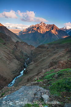
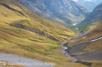
Hidden Creek valley, in the Wrangell mountains. A popular backpacking route, Hidden Creek in the Wrangell Mountains is a wonderful hike. Wrangell-St. Elias National Park and Preserve, Alaska.

Hidden Creek valley, in the Wrangell mountains. A popular backpacking route, Hidden Creek in the Wrangell Mountains over to the Lakina River is a wonderful hike. Wrangell-St. Elias National Park and Preserve, Alaska. Please click on the image to view a larger version of the photo.

Hey Folks,

I’ve headed out again for the next trip, but will schedule this post in advance. This is from close to the pass above Hidden Creek, looking back down the valley we’d just hiked. We walked up the south side of the valley (right side in the frame), then crossed and climbed up to a bench on the north side of the pass. Camping up there was simply awesome. 2 bands of Dall sheep were wandering the mountains above us, and we saw mountain goats higher still.

Hidden Creek is simply stunning. This particular afternoon, we crested the pass and camped on the other side of the saddle, which is where the previous post’s photo (“Reflections”) was taken. Suffice it to say that the back half of the trek is just as rocking as the front half.

Suffice it to say, I’ll be on this route again next year. 🙂

Cheers

Carl

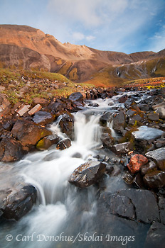
Waterfall – Wrangell St. Elias

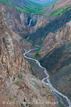
A waterfall in the high alpine mountain country of Wrangell-St. Elias National Park and Preserve, Alaska.

A waterfall in the high alpine mountain country of Wrangell-St. Elias National Park and Preserve, Alaska. Please click on the image to view a larger version of the photo.

Hey Folks,

Here’s a waterfall from our trip up Hidden Creek, in Alaska’s Wrangell-St. Elias National Park and Preserve. This particular morning, I knew exactly what I wanted to shoot; I’d hiked up to the area here, above our camp, the evening and poked around a bit, looking for some scenes to shoot. As the following morning broke, I stole away from camp, camera in hand, and spent a few hours up here photographing.

For this image, I believe I used a crappy old scratched up 2-Stop Soft Edge neutral Density filter from Singh Ray – knowing I would get back home after the trip to open a box from B&H photo with 2 shiny new scratch-free filters awaiting me.

I still prefer to shoot with a filter, when possible, over taking multiple exposures and blending them together later. But damn if those filters don’t get all scratched up easily.

Not too long after shooting this frame, I was seated in my thermarest chair, enjoying a coffee and Mary Jane’s Farm organic oatmeal – mmhhhmmm!

Quite a nice morning. Sadly, it ended all too briefly, as we had to break camp and backpack up over the pass. Good thing we didn’t linger too long though, as we arrived just in time to get setup before the rains came. It’s nice to have the tents and cook tarp set up BEFORE the rains/sleet/hail/snow come down.

Cheers

Carl

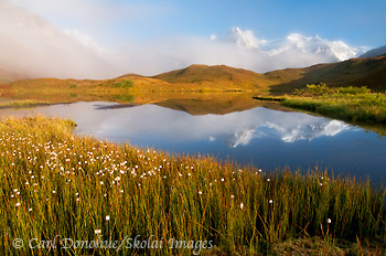
Reflections

The Wrangell Mountains, covered in fresh snow, or 'termination dust', in early fall, and reflection in a small unnamed alpine lake. Wrangell mountains, Wrangell-St. Elias National Park and Preserve, Alaska.

The Wrangell Mountains, covered in fresh snow, or ‘termination dust’, in early fall, and reflection in a small unnamed alpine lake. Wrangell mountains, Wrangell-St. Elias National Park and Preserve, Alaska. Please click on the image to view a larger version of the photo.

Hey Folks,

How’s this one for a turn around? I just got back from a great hike with the Ball family, a trio of Texans who came up to Alaska in 2006 and ventured out on a trip that still stands on record as the worst weather of any backpacking trip I’ve ever done. 10 days solid of near snow, ice sleet and rain the entire trip!

Hardy folks, these texans; amazingly, they came back this year for round 2. Somewhat trepidatiously, I cautiously planned the hike. We scheduled it for a route that I walked last year in nothing but horrible weather .. I figured this way, when the Texans brought their nasty weather up here, I’d be on a route I was comfortable hiking in bad weather. 🙂

Here’s the scene I awoke to Sunday morning – this is the view literally outside my tent door. What a fantastic morning, and trip overall, this was. Some great people, great scenery, and great weather. Welcome to Alaska, Texans!

We laughed a lot, hiked a lot, ate a lot, and enjoyed some of the best mountain scenery Alaska, or anywhere else, has to offer. Wrangell-St. Elias National Park and Preserve – best viewed from my tent door.

Cheers

Carl

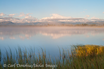
Mount Sanford reflection

Mount Sanford and reflection, Wrangell St. Elias National Park and Preserve, Alaska.

Mount Sanford and reflection, Wrangell St. Elias National Park and Preserve, Alaska. Click on the thumbnail to view a larger version of the photo.

Hey Folks,

Here’s a shot from my trip this last week to Wrangell St. Elias National Park and Preserve. I’m so wanting this shot to come together – as many times as I’ve been here, and waited for the right light, it hasn’t happened yet. This particular morning the air was calm, so the reflection was nice, and the mist added a nice touch, but the alpenglow, earlier in the morning, didn’t happen.

What’s the longest hour of a landscape photographer’s day? That hour between when the light first touches the clouds/mountain tops and when the sun actually rises high enough to light up the valley floor. Standing around, wet and cold, for an hour waiting to see if “Stage II” of the morning light happened, is a tough choice. But, then the light comes up, and it’s all forgotten. What fickle creatures we can be.

I’m pressed for time folks, but I’ll try to schedule another post or 2 for this next week. I just got in this evening and am heading out again sunday morning for 10 days. See ya soon.

Cheers

Carl

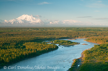
Copper River, Wrangell Mountains, Simpson Hill Overlook

The Copper river and Mt Drum, from Simpson Hill Overlook. View of the Copper River basin and Wrangell Mountains, Wrangell-St. Elias National Park and Preserve, Alaska.

The Copper river and Mt Drum, from Simpson Hill Overlook. View of the Copper River basin and Wrangell Mountains, Wrangell-St. Elias National Park and Preserve, Alaska. Please click on the image thumbnail to view a larger version of this photo.

Hey Folks,

OK, enough with the waterfalls already! Here’s another image from my spring trip earlier this year, from Simpson Hill Overlook, off the Richardson Highway, near Glennallen, Alaska. This is a scene I’ll never tire of; looking down the Copper River, with the Wrangell Mountains in glorious sunshine. The mountains you can see in this image are Mt. Drum on the left and Mt. Wrangell the broader, dome-shaped mountain on the right in the background.

Just out of sight to the left of the frame is Mt. Sanford, and  Mt. Blackburn to the right. How many vantage points do you know of in North America where you might choose to exclude from your photo two mountains both of which stand over 16 000′ high? That speaks volumes, in my opinion, about how amazing this viewpoint is. The 5th (Blackburn) and 6th tallest peaks (Sanford) in the US and they don’t make the photo? Craziness!

The Copper River is pretty grand too. Not to get bogged down by meaningless numbers and superlatives, but the Copper River is 300 miles long, and the 10th largest river, by volume, in the US. The Copper River is also the north and western boundaries of Wrangell-St. Elias National Park and Preserve, coolest park in all the world! It’s perhaps best known, however, for its nearly infamous Red Salmon run, usually over 2 million spawning salmon, loaded with fatty Omega-3 oils that make for some delicious supper.

I was really hoping for some sweet delicious alpenglow on this particular evening …. but ….. alas, such wasn’t to be my fortune. The light faded soon after I shot this – the boreal forest in the foreground grew dark, and the mountain light ebbed and dwindled; distant dim clouds low on the northwestern horizon thwarted my efforts at capturing some rich color on the snow-capped peaks, as seems to be the case all too often.

This scene is one of the very few ‘roadside‘ vantage points from which to photograph some of the big mountains in Wrangell-St. Elias National Park and Preserve. Willow Lake is another. The views on a clear day from these places rival anything I’ve seen anywhere else. The problem, I guess, for photographers is that the clear days are few and far between. Enjoy ’em when ya can! 🙂

Cheers

Carl

Bridal Veil Falls Photo, Keystone Canyon

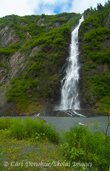
Bridal Veil Falls, Keystone Canyon, Richardson Highway, Valdez,

Bridal Veil Falls from the Richardson Highway, near Valdez, Alaska. Keystone Canyon, Lowe River, Chugach Mountains, Central Alaska waterfalls. To view a larger version of the photo, please click on the thumbnail.

Hey Folks,

Here’s a photo I took this spring on a quick trip down the Richardson Highway to Valdez. Kind of a spur of the moment thing, I took off from Glennallen one rainy, nasty morning to revisit the area. I hadn’t been down to Valdez in years, and so it was a nice way to spend what looked like might be a day of dreary weather. I also wanted to photograph a couple of the waterfalls along the road, this one and Horsetail Falls as well, which is just around the bend from Bridal Veil Falls.

This kind of location is difficult to shoot, for me, as the scene doesn’t offer a lot of options regarding a vantage point. The river in the foreground, Lowe River, is uncrossable, unless you have a boat. I, of course, did not have a boat with me. So the photographer here is pretty limited to shooting from across the river, and that makes it difficult to come up with any compositional variations.

Similarly, without a heavy overcast day, including the sky wasn’t a great option either. The road runs immediately behind where I shot this image from, so backing away would drastically change the nature of the photo, by including the road in the foreground. Not necessarily a bad thing, but that wasn’t what I was looking for. Perhaps I’ll go back one day in better conditions and shoot it again, with the road and a motor vehicle in the foreground, as a ‘travel photo‘.

Continue reading

Arctic Ocean, ANWR, Alaska.

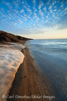
The Beaufort Sea along the coastal plain of the Arctic National Wildlife Refuge (ANWR). The Arctic Ocean sea ocean, after spring breakup, rests on the beach. Melting permafrost in the bluffs signals warming temperatures. Arctic Ocean, Coastal Plain, ANWR, Alaska.

The Beaufort Sea along the coastal plain of the Arctic National Wildlife Refuge (ANWR). The Arctic Ocean sea ocean, after spring breakup, rests on the beach. Melting permafrost in the bluffs signals warming temperatures. Arctic Ocean, Coastal Plain, ANWR, Alaska. Click for a larger photo.

Hey Folks,

Another photo from our recent trip to the Arctic National Wildlife Refuge and the Beaufort Sea. I hiked from our final camp across the coastal plain (well, across part of the plain, not the whole thing) with Steve Weaver hoping to photograph some of the icebergs we’d seen the previous day along the shoreline. Unfortunately, strong southerly winds had blown almost all the ice out to sea, and we were largely thwarted. This patch of ice, however, had been resting on shore, stranded when the tide rolled out, and we made a few images.

Coastlines are such dynamic landscapes, and in the Arctic particularly so. They can change drastically in a day or less, and do so frequently.

This photo was taken around 1:15am .. maybe later. I think Steve and I arrived back at camp around 4:00am, and I went to bed at nearly 5:00am. up at 10:00am-ish to break camp, roll the raft, and wait for a bush plane. We arrived, finally, in Coldfoot, around 5:30pm,(the temp was 90deg F, a start contrast from the Arctic Ocean we’d just left) unpacked the gear from the plane, sorted it and loaded the van, ate dinner, and hit the road, rolling into the Yukon River area stop late at night. Then up early the next morning to drive from there to Anchorage. 36 hours later it was out the door to pick up folks for the next trip to Wrangell-St. Elias National Park and Preserve. Summertime can be like that in Alaska.

I’ve been out to the Beaufort Sea here a number of times, now every time I’ve been so fortunate as to have an absolutely glorious final evening. The wind wasn’t bad at all, the bugs had quieted down, and the expansive vastness of the place really moves me. It’s a fantastic experience, to see such a harsh and rugged environment also be so sensitively fragile; the quiet tundra, the shorebirds, a whisper of air and the glowing rays of the sun, low on the horizon. After the trek back to camp I simply couldn’t go to bed, but sat for nearly 45 minutes by my tent, just watching, listening and enjoying the grace of the Arctic coastal plain. It’s a phenomenal place.

The bluffs on the left of the frame, like Castles Made of Sand, slowly slip into the sea – eventually.

Cheers

Carl

Chitistone falls, Wrangell-St. Elias National Park

Chitistone Falls, in the Chitistone valley. The Goat Trail is a popular backpacking route, from Skolai Pass to Glacier Creek, along the Chitistone River, in Wrangell-St. Elias National Park and Preserve, Alaska.

Chitistone Falls, in the Chitistone valley. The Goat Trail is a popular backpacking route, from Skolai Pass to Glacier Creek, along the Chitistone River, in Wrangell-St. Elias National Park and Preserve, Alaska. Please click on the thumbnail to view a larger version of this photo.

Hey Folks,

Chitistone falls are one of my favorite waterfalls in the park yet I rarely get to see them. When I do the Goat Trail now, I head north after crossing the scree slopes, and go away from the Chitistone river, rather than down lower toward the river, which is the only way to view the falls. However, this particular evening was so nice that after dinner I headed out for some photos, and knew right away I’d be spending some time watching and photographing the falls. It’s a tough slog to walk another 4 miles after backpacking all day, but can be SOOOOO worth it.

The trek down from where we’d camped was nice; it’s great to walk unencumbered after carrying a heavy backpack all day. I set out with my camera bag over my shoulder and my small backpacking tripod in one hand. For trekking I carry the carbon fiber Gitzo G1058  tripod and the ultra light Really Right Stuff BH-25 ballhead. It’s a great little combo for backpacking and hiking, weighing under 2lbs. Gitzo have since replaced this model with a newer version, the GT-0540 and GT-0530. I’m not sure how they’re different to my older one, but if you’re looking for a really great little hiking rig, this setup works well for me.

So I moseyed my way down from the high shoulder we were camped on, watching the light get sweeter and sweeter on the nearby high peaks of the University Range. When the weather is nice, few things are quite like walking alone  in the Alaska mountains late in the evening. What a beautiful hike this is!

I got down to the plateau I was aiming for, and, before even pulling out my camera, simply soaked up the atmosphere. The American Tree Sparrows were still singing their summer call, those 3 vibrato-laden little notes that proclaim the alpine summer. Hardly a breath of air moved and yet the sounds of the mountains carried down the valley; a moving experience in the Chitistone Canyon.

The word ‘Chitistone‘ is derived from  a native Ahtna (Athapaskan) word, ‘chiti‘, that translates as ‘copper‘ in English; so ‘chitistone‘ is ‘copper stone‘. The bulk of the rock around the Chitistone canyon is Nikolai greenstone and limestone. The entire region is famous for copper production, with Kennicott Copper Mine being perhaps the most famous of all. Fortunately, the mining has largely ended in the region now, and the canyons and mountains are left alone for the bears and Dall sheep and hikers, and the mountains themselves. It’s a grand landscape.

On a warm summer day, when the glacial melt is high, the river is fairly broiling, and the falls can be thunderous. Quite a spectacle.

This particular viewpoint has always reminded me of Artist Point, in the more famous Yellowstone National Park. This one receives far fewer visitors.

Chitistone Canyon rocks.

Cheers

Carl
Chitistone, the Goat Trail, Wrangell-St. Elias National Park.

Sunset over the Chitistone Valley and University Peaks.

Sunset over the Chitistone Valley and University Peaks. Mount Bona stands in the background. Please click on the thumbnail to view a larger version of the photo.

Hey Folks,

One gorgeous evening, a 2 mile hike (one-way) from camp and some more photos that I had been hoping for some time now to make. Lucky me!

We just trekked from Skolai Pass, in Wrangell St. Elias National Park and Preserve, to ‘Wolverine‘, a landing strip high above the Chitistone Valley, over the relatively popular ‘Goat Trail‘. This is a classic hike, and one I try to make every summer. Before I talk about it further, I’ll qualify what I mean by ‘popular’ here.

Probably not 50 people hike this route each year, more likely 40, at most. Consider, for example, that nearly TWO THOUSAND people venture to hike the entire Appalachian Trail each year, and one starts to see that the word ‘popular‘ is entirely contextual. I only say ‘popular‘ here because so few people hike anywhere else in Wrangell-St. Elias National Park.

We had a real mix of weather on this trip, so I was SUPER lucky to grab such a gorgeous evening here at this location. the clouds dissipated throughout the course of the day, which we spent backpacking across the Goat Trail, a steep sloping scree-sided series of ravines, traversed by a meandering myriad sheep and goat trails; hitting the correct ones makes a huge difference on how easy the traverse is. The ‘wrong’ ones can easily be impassable for people, especially those carrying heavy backpacks. Continue reading

The Brooks Range, ANWR

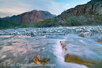
A flowing stream and tiny waterfall, near the Marsh Fork River, Brooks Mountain Range, ANWR, Arctic National Wildlife Refuge, Alaska.

A flowing stream and tiny waterfall, near the Marsh Fork River, Brooks Mountain Range, ANWR, Arctic National Wildlife Refuge, Alaska. Please click the thumbnail to view a larger version of the photo.

Hey Folks,

Wow – what a great trip we just had in the Arctic National Wildlife Refuge (ANWR); I rafted the Marsh Fork and the Canning River, through the Brooks Mountain Range and across the coastal plain to the Beaufort Sea, the Arctic Ocean, with a great group of folks. This photo was taken the first night of our trip, just a short hike from our camp on the Marsh Fork. It was pretty late, maybe around 1am or so, I can’t recall exactly.

The trip was fantastic, thanks to some great weather, very few mosquitoes, good food and a really, really great group of folks. I wish had more time to write about the trip, and post a few more photos, but I just got back in last night and am leaving tomorrow morning for an 8 day backpacking trip in Wrangell-St. Elias National Park. Until then, I hope you like this photo of the Brooks Range, ANWR.

Cheers

Carl