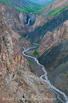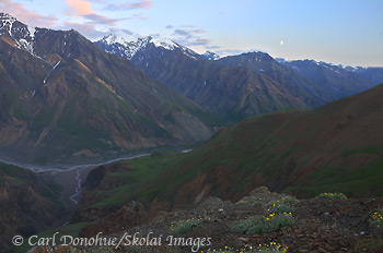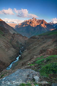
Chitistone Falls, in the Chitistone valley. The Goat Trail is a popular backpacking route, from Skolai Pass to Glacier Creek, along the Chitistone River, in Wrangell-St. Elias National Park and Preserve, Alaska. Please click on the thumbnail to view a larger version of this photo.
Hey Folks,
Chitistone falls are one of my favorite waterfalls in the park yet I rarely get to see them. When I do the Goat Trail now, I head north after crossing the scree slopes, and go away from the Chitistone river, rather than down lower toward the river, which is the only way to view the falls. However, this particular evening was so nice that after dinner I headed out for some photos, and knew right away I’d be spending some time watching and photographing the falls. It’s a tough slog to walk another 4 miles after backpacking all day, but can be SOOOOO worth it.
The trek down from where we’d camped was nice; it’s great to walk unencumbered after carrying a heavy backpack all day. I set out with my camera bag over my shoulder and my small backpacking tripod in one hand. For trekking I carry the carbon fiber Gitzo G1058 tripod and the ultra light Really Right Stuff BH-25 ballhead. It’s a great little combo for backpacking and hiking, weighing under 2lbs. Gitzo have since replaced this model with a newer version, the GT-0540 and GT-0530. I’m not sure how they’re different to my older one, but if you’re looking for a really great little hiking rig, this setup works well for me.
So I moseyed my way down from the high shoulder we were camped on, watching the light get sweeter and sweeter on the nearby high peaks of the University Range. When the weather is nice, few things are quite like walking alone in the Alaska mountains late in the evening. What a beautiful hike this is!
I got down to the plateau I was aiming for, and, before even pulling out my camera, simply soaked up the atmosphere. The American Tree Sparrows were still singing their summer call, those 3 vibrato-laden little notes that proclaim the alpine summer. Hardly a breath of air moved and yet the sounds of the mountains carried down the valley; a moving experience in the Chitistone Canyon.
The word ‘Chitistone‘ is derived from a native Ahtna (Athapaskan) word, ‘chiti‘, that translates as ‘copper‘ in English; so ‘chitistone‘ is ‘copper stone‘. The bulk of the rock around the Chitistone canyon is Nikolai greenstone and limestone. The entire region is famous for copper production, with Kennicott Copper Mine being perhaps the most famous of all. Fortunately, the mining has largely ended in the region now, and the canyons and mountains are left alone for the bears and Dall sheep and hikers, and the mountains themselves. It’s a grand landscape.
On a warm summer day, when the glacial melt is high, the river is fairly broiling, and the falls can be thunderous. Quite a spectacle.
This particular viewpoint has always reminded me of Artist Point, in the more famous Yellowstone National Park. This one receives far fewer visitors.
Chitistone Canyon rocks.
Cheers
Carl


