Dall sheep ewe, Wrangell-St. Elias National Park

A dall sheep ewe stands on a ridge above the Chittistone Valley, in Wrangell-St. Elias National Park, Alaska.

Hey Folks,

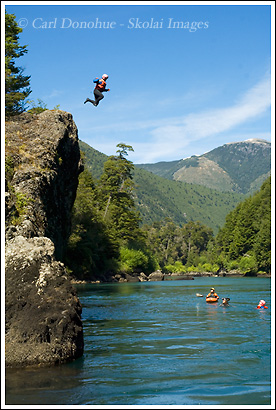
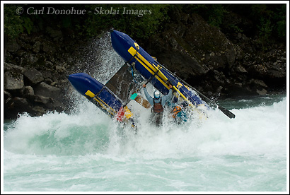
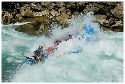
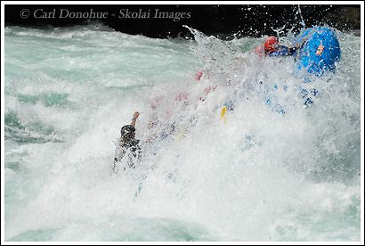
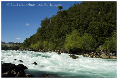
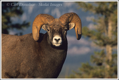
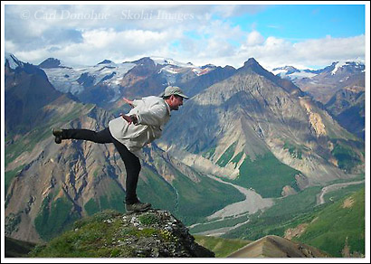
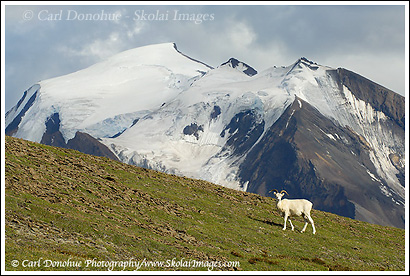
OK, I’ll stop with the photos from Chile, taken a year ago. Here’s another image from this past summer, of a Dall sheep ewe we saw on the Skolai to Wolverine trip. We saw numerous Dall sheep along the way, but this one I was able to get close to and make some decent photos.

It took me quite a while, as it usually does shooting Dall sheep in Wrangell-St. Elias National Park and Preserve, because they’re pretty skittish.

Hunting is allowed in the preserve, and is allowed in the park by subsistence permit only – meaning locals are allowed to hunt pretty much wherever they choose, provided they don’t use motorized transport to get there – so they can’t fly in via bushplane to a place like this and hunt, but they can come in and hunt here if they travel on foot – not very likely.

However, even though hunters don’t get in to a place like this very much, the sheep are still very wary – I guess word gets around. Also, so few wildlife photographers spend any time in the park, the animals don’t learn to trust people, so the remain pretty skittish.

One more post for 2007!

Cheers

Carl

Adventure vacations on the Futaleufu River, Chile

Rock Jumping, Futaleufu River, Chile

Rafters take a  quick break for a rock jumping session on the Futaleufu River, Patagonia, Chile.

Sometimes we’d run a full river trip down the Futaleufu instead of the more common “Bridge to Bridge” section, which is the standard day-trip, about 12km of solid whitewater.

On the full river section, we’d usually make it an overnighter, and enjoy the flatwater runs between the various sections of whitewater. Halfway along the trip is this killer place to go rock jumping. A nice sunny day, a deep, flat pool of water and a high ledge made for great fun for everyone.

You’ll notice Gabby in the orange Jackson kayak just downstream, in position in case anyone got hurt jumping and needed some assistance. As always, safety first.


Cara del Indio, which translates in English as "Face of the Indian", a rocky outcrop that resembles a face of a wizened old Indian, the Mapuche. Futaleufu River, Chile.

This image is of a rock form called “Cara del Indio”, which translates to english as “Face of the Indian” – because the rock form resembles the profile of face of a wizened old Indian; the native people of this area were the Mapuche, who were mostly wiped out by the Spanish Conquistadors. The word “Futaleufu” by the way, is a Mapuche word that translates as “Big Water”, and yes indeed, the Futaleufu River is Big Water. Chile.

Oh, I should’ve added: this feature is just before Mundaca. Generally rafting trips will pull over on to a small beach below Cara del Indio, have a quick rest, and the guides will go over the plan for running Mundaca – it also allows the safety boats, like the cataraft and a kayaker or 2, to get ahead and set up for safety, if needed.


Cataraft flip in Mundaca, Futaleufu River, Chile

A cataraft flips over in the massive Class IV rapid, Mundaca, on the Futaleufu River, Patagonia, Chile.

Hey Folks,

So, I’ll wrap up my Mundaca Series here. This is a safety boat, a cataraft, that runs the river ahead of the whitewater rafts, and gets set to pick up folks who might fall out of the rafts. Of course, that’s the plan, but if the cataraft flips, then the safety is shot. Generally, using a series of hand signals and keeping a watchful eye out, something like this will be communicated back upstream to let the guides of the rafts know they have no safety. In which case, they generally wait until the cataraft is either flipped back over, or they’ll continue on down the river, but run a more cautious line. I shouldn’t say there’s no safety – on a river like the Futaleufu, each whitewater rafting trip

Continue reading

More Mundaca fun, Futaleufu River, Chile

Whitewater Rafting, Mundaca, Futaleufu River, Patagonia, Chile.

Merry Xmas Folks!

Here’s a similar shot to the one I posted of KC going vertical in Mundaca.

The guide is Manu, from Switzerland. Manu was the king of going big on the Futaleufu in 2007. Nobody had the number of big hits that Manu did. And he cooks up a helluva storm too!

It’s awesome being around people who get so excited about what they do – Manu’s eyes lit up everytime we got to Cara del Indio, a little beach right before we’d hit Mundaca. The excitement builds, and everyone just knows he’s going big. – right down the center.

Awesome stuff.

And, because it’s Xmas, I’ll post a couple of shots to show you what happens after your raft hits this rapid, IF it doesn’t flip over:

Continue reading

Whitewater rafting, Mundaca, Futaleufu River, Chile

A Whitewater rafting trip on the Futaleufu River hits a Class IV rapid, Mundaca, and goes vertical. Futaleufu River, Patagonia, Chile

Hey Folks,

Ahhh – the days feel longer already. It’s like Boxing Day for Solstice.

I told you I’d show a couple of photos of how big Mundaca is. This is my friend KC, from New Zealand, guiding a 16′ raft through the entrance wave of Mundaca. One guide plus 6 people in a heavy raft and the wave stands it up almost totally vertical. Some awesome power in the water here. KC’s a killer guide, he’s worked on rivers all over the world, including the Zambezi and the White Nile in Africa. Not too bad for a Kiwi!

Shooting whitewater rafting photos is kinda hard – I found the hardest thing was to not fill the buffer – mostly because the rapids were so big, I could shoot the whole series and still miss stuff. The D2x has a buffer of 17 shots when shooting raw files, and it’s amazing how quickly they go by when you shoot 5 frames per second.

Continue reading

Mundaca Rapid, Futaleufu River, Patagonia, Chile

The rapid known as Mundaca, a Class IV kayaking and rafting rapid on the Futaleufu River, in Central Patagonia, Chile.

Hey Folks,

Happy Winter Solstice!

Here’s a look at the rapid from yesterday’s photo, Mundaca. This photo is looking up at the top section of the rapid, where the river narrows rapidly, hits a few pretty large boulders, and goes every which way but loose. This angle doesn’t really give you a great look at the rapid (pronounced Moon – Dahka), but I like the scene. You can’t see down into those holes and waves, but I’ll make a few posts over the next couple of days showing the rapid a little better, as well as some action from there. We had some pretty big hits on Mundaca last year, with a bunch of rafts flipping. I proudly can tell you that the company I worked with had the most flips of the season at over 16. Pretty cool!!! Go big, or go home.

As the summer progressed, the everyone became more familiar with Mundaca, and also the water level changed enough to make it safer to go straight down the middle. At high water levels, flipping is more dangerous for a few reasons:

* the water’s flowing faster.

Continue reading

Bighorn Ram, Jasper National Park, Alberta, Canada

Bighorn ram in the Canadian Rockies, Jasper National Park, Alberta, Canada.

Hey Folks,

A few more posts before the electricity goes and I scrounge around in the eternal darkness of the Alaskan winter. This one is a bighorn ram that I photographed on my first trip to Jasper National Park a few years back. I recently rescanned it, and am spending some downtime now getting caught up on editing and processing images. It’s funny looking at scans of slides these days, after shooting digital for just a few years. Pretty amazing the difference – though I think that’s a function of scanning more than film versus digital quality.

Well, it’s insanely past my bedtime, and I’ve had a big day, so this will be short and I’ll head to my room. You all have a good one and enjoy it while you got it – whatever it is.

Oh wow – just as I’m ready to hit “publish”, one of the dogs upstairs goes insanely off her head. At this time of night that means one thing: I looked outside and there’s 2 moose in the front yard. How cool is that? A cow moose and her calf under the street lights wandering through the front yard. Awesome!

Cheers

Carl

The McCarthy Road, Wrangell-St. Elias National Park

Sign warning of danger, dangerous weather and road conditions on the McCarthy Road, in winter, Wrangell-St. Elias, Alaska.

Hey Folks

Well, I’ve not got a lot to tell you, unfortunately. For various reasons, none to exciting, I’m in Anchorage until after the holiday. Around the first of the year I’ll be heading to McCarthy. Not for a trip, but for the winter. Update (actually it was 2 awesome winters).

That’s right, I’ll be staying just outside a town that has about 5 people in it during the winter. I’m not sure how often I’ll get internet access, but hopefully I can work that out and stay in touch. For those of you who don’t know much about McCarthy, the photo posted here gives you a little idea.

Continue reading

Hopscotch above the Chittistone River

Hiking and trekking above the Chittistone River, Chittistone, Valley, Wrangell St. Elias National Park, Alaska.,

Hey Folks,

This will be my last post here for a while. I’m heading off to the big wilderness again in the morning. This time, my plan is a little different. I’ll be over in the park until just before Xmas, when I have to return to Anchorage and baby sit 2 dogs, Keba and Musa, until the new year – then I’ll be back over to the park scrounging around in the dark.

Continue reading

Chattooga River Photo, North Georgia Mountains.

Chattooga River, whitewater paradise, Jawbone Rapid, Five Falls area, Georgia - South Carolina Border

Hey Folks,

I’ll maybe try to get one more post in here before I hit the road, so I’ll do 2 for today. This is a photo from the past. I’ve been catching up on some editing and web updates he last few weeks here, and haven’t really got out to shoot too much. As a result of that, I’ll try to post a couple of shots from years gone by that I like – and maybe even post a few of the countless thousands I didn’t like. 🙂 This photo was from an overnight trip a couple of years ago to the Chattooga River in north east Georgia. The Chattooga River defines the border between Georgia and South Carolina, and lies between the Sumter , Nantahala and Chattahoochee National Forests.

Congress designated the Chattooga River a “Wild and Scenic River” in 1974, and I’d attest to that designation. It’s both wild and scenic! The designation protects a corridor along the river for nearly 60 miles, though it’s somewhat silly

Continue reading