Tag Archives: scenics

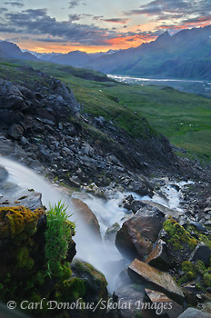
Iceberg Lake photo, Wrangell-St. Elias National Park

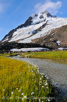
Alaska Cotton, and glacier, Wrangell-St. Elias National Park and Preserve, Alaska.

Alaska Cotton, and glacier, near Iceberg Lake, Wrangell-St. Elias National Park and Preserve, Alaska. Please click on the image above to view a larger version of this photo.

Hey Folks,

We just got off a great hike in the Chugach Mountain Range, Wrangell-St. Elias National Park; the Iceberg Lake to Bremner Mines route, a popular hike I’ve done a number of times now. This trip was an exciting adventure, as always, with a mixture of weather, some great folks to hike with, tons of cool stuff to see.

We actually took what is for me a new route part of the way, and skipped one of the climbs; heading straight for a glacier moraine and on to the ice instead. That was kinda cool, and I did find a great spot to camp that I hadn’t been to before, which is always a treat.

This image is from the first morning of the trip, when the skies cleared and we had some nice morning light. The day before it had been drizzly and overcast, and we hiked along the now empty lakebed of Iceberg Lake; it drains every summer.

After a hearty breakfast and packing up camp we headed off across a glacier and up higher to another campsite, where we did a short dayhike down to a few small alpine lakes. Great day indeed. The weather changed a lot during the 8 days of our trip, and we were constantly layering clothes on and off. The wind was cold, even on the sunniest of days, and fall is most definitely here in Alaska.Fresh snow on the peaks around us, the locals calls “Termination Dust” (i.e., the termination of summer) greeted us a number of mornings.

We made it to our pickup at Bremner Mines on time, and then had to wait for a break in the weather before our pilots came and got us, ferrying us quickly back to McCarthy, hot food, showers, chairs with backs, and all the comforts of the a small town. Good times.

Great trip, all in all.

Cheers

Carl
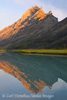
Caliban, Arrigetch Peaks, Gates of the Arctic

Caliban, Arrigetch Peaks, Gates of the Arctic National Park, Alaska.

Caliban, Arrigetch Peaks, Gates of the Arctic National Park, Alaska. Please click on the image above to view a larger version of this photo.

Hey Folks,

Here’s a quick shot of Caliban, from the Arrigetch Peaks. Interestingly, I shot this image just minutes after I dropped my 18-70mm lens into a small pond and totally destroyed it; the lens still have grit and glacial silt inside it from the Arrigetch Peaks; I know the NPS have a rule about “take only pictures”, but I figured if my lens was busted, and I couldn’t really take pictures any more, it might be OK to take some glacial silt with me.

Gates of the Arctic National Park hiking trips.

Cheers

Carl

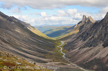
Down Arrigetch Creek

Arrigetch Creek, Arrigetch Peaks, Gates of the Arctic National Park and Preserve, Alaska.

View down Arrigetch Creek, from near Escape Pass, and the peak called Albatross. Elephant’s Tooth visible in the distance. Arrigetch Peaks, Gates of the Arctic National Park and Preserve, Alaska. Please click on the image above to view a larger version of this photo.

Hey Folks,

So here’s the view from my previous blog post in reverse; that shot looks up the valley towards where this one was taken. The peak at the far end of the valley, on the right hand side, is known as Elephant’s Tooth, a classic granite outcrop in the Arrigetch Peaks. The creek here is Arrigetch Creek (I’m not sure, but the word “Arrigetch” may well be a traditional Native Alaskan word meaning “rains like a sonuvagun” or something similar)

We hiked up this valley, climbed up high and had supper on a small plateau above the valley. A really great spot to camp. The next morning we ate breakfast and packed up, heading higher still to cross thru a high narrow pass towards another drainage, but we were thwarted by a nasty storm and precipitous granite; in the stormy weather I had neither the time nor inclination to scrap around and find a safe route across the steep traverse on the other side, and we descended to the valley floor after lunch.

Sometimes safety means turning back. But what a place to turn back toward, eh?

Cheers

Carl

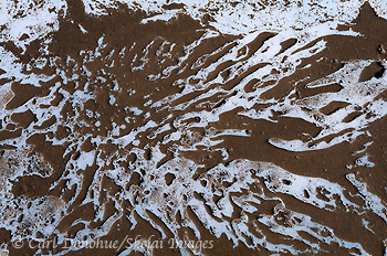
Nizina Glacier photo, from above

Nizina Glacier, Wrangell-St. Elias National Park and Preserve, Alaska.

Ice and dirt patterns, Nizina Glacier, Wrangell-St. Elias National Park and Preserve, Alaska. Please click on the image above to view a larger version of this photo.

Hey Folks,

A view from above; looking down on to the Nizina Glacier, Wrangell-St. Elias National Park and Preserve.

Bob and I hiked around on the Nizina Glacier all afternoon, exploring the expansive icy landscape. Good times indeed, and a myriad different (temporary) photo opportunities. I say “temporary” because many of them were gone the following week when acres of the glacier calved from the main glacier into the lake, fractured, up-ended and disappeared down river. I flew over the Glacier maybe a week after our hike and much of the area we had traversed was gone. Cool stuff.

Glaciers are incredibly dynamic landscapes, and always a blast to explore, travel and photograph. As such they can be a dangerous place to navigate, but so can the streets of Anchorage (especially if you’re on a bicycle); caution is required, certainly, but glaciers are a fascinating subject.

Cheers

Carl

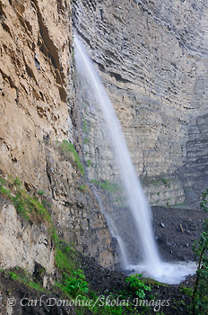
Waterfall photo

Waterfall, Wrangell-St. Elias National Park and Preserve, Alaska.

Waterfall and sedimentary cliff walls, Wrangell-St. Elias National Park and Preserve, Alaska. To view a larger version of this photo, please click on the image above.

Hey Folks,

OK OK OK .. another waterfall photo. What can I say? Generally when I visit Wrangell-St. Elias National Park, we do a fly-in backpacking trip, meaning we take a bush plane flight out to the backcountry, and backpack from there. The flights are amazing, and give an incredible view of this landscape, but they’re also a bit of a tease; every flight I make I see different scenes and valleys and peaks and drainages and think to myself how much I’d love to visit this one or that.

One of the big ones on that list is waterfalls; we fly by dozens of them, every summer, and I think how nice it’d be to get a chance to shoot some of them sometime. Once we land, up high in the subalpine, we rarely visit such waterfalls at all, as we tend to hike where the water accumulates, rather than down lower where the water has collected into larger waterways, creating larger waterfalls. So when I got a chance to shoot a couple this spring, I jumped at it.

This is another angle of the waterfall I posted a photo of last month. I spent a bit of time at this waterfall, trying to find some angle that lent itself to a pleasing image. it was a lot harder to do than might appear; there was an incredible volume of fallen rock and debris in the river channel below the falls, and the small pool into which the falls tumble wasn’t visible from many angles at all; meaning the bottom of the falls would disappear in virtually every shot. This angle was one of my favorites, giving an intimate look at this stream of water shooting down from above.

Like so many of the landscape features in Wrangell-St. Elias National Park, this waterfall is officially ‘unnamed’; what do you think might be an appropriate name for this waterfall?

Cheers

Carl

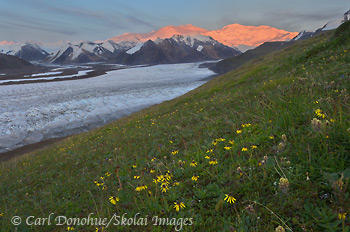
Mount Bona and alpenglow

Mount Bona, Wrangell-St. Elias National Park and Preserve, Alaska.

Russell Glacier and Mount Bona and Mount Churchill, alpenglow at sunset, and an array of wildflowers in Wrangell-St. Elias National Park and Preserve, Alaska. Please click on the image above to view a larger version of this photo.

Hey Folks,

Here’s an oldie but a goodie; well, not really an ‘oldie’ in the sense of a photo I took a long time ago, but a recent version of a favorite scene of mine; Mt. Bona, Mt. Churchill, the University Peaks and the Russell Glacier, Wrangell-St. Elias National Park and Preserve. I shot a very similar composition to this a few years ago on a Skolai Pass Photo Tour in the fall.

We very nearly didn’t get this scene last week. After a long backpack (made even longer by twice running a grizzly sow with her 3 cubs) we made camp and had a well – deserved supper. Tired, I watched as the light started to get better in the late evening, and thought it might be worth a hike a little further over toward this scene. In part because I wanted to shoot the alpenglow, but also because I wasn’t sure if the weather would hold until the next day, and I so wanted the 2 people on the trip to get to see this view while it was clear; I convinced one of the folks to join me for a walk, and we headed off toward the glacier.

When we arrived, the sun was still well up, and the light not nearly so warm. We made some photos, scouted out possible compositions, and waited around for the evening light; instead, the light faded; distant clouds behind us blocked the fading sun from the mountains, and the light dimmed. I thought it might be worth heading back toward camp in the hope of maybe catching some colorful clouds at sunset. We walked about 10 minutes in that direction and starting shooting some images in that area. I turned and saw the light in this direction start to glow again, and knew it would be a good idea to head back.

I had to hustle back got back just in time to catch the last of the alpenglow. Having already been here earlier, I knew exactly the foreground I wanted, which lens and composition I wanted, and this shot was merely a matter of pointing and shooting.

I guess in some ways this scene isn’t anything new, as I’ve shot almost from this very spot before; but it’s not a bad place to spend a nice afternoon, and even make some photos all the same.

Cheers

Carl

Waterfall and sunset at Skolai Pass

Waterfall and sunset, Wrangell-St. Elias National Park and Preserve, Alaska.

A waterfall, known as Roane Falls, glows in the light of a colorful sunset. Near Chitistone Pass, looking toward Skolai Pass, Wrangell-St. Elias National Park and Preserve, Alaska. Please click on the image above to view a larger version of this photo.

Hey Folks,

Roane Falls near Chitistone Pass, is a little known, and even less photographed, waterfall in Wrangell-St. Elias National Park and Preserve. This is another image from the same sunset in the previous image here.

We were on a hiking trip in the area last week, and were treated to some gorgeous weather (along with the obligatory nasty weather as well);  The days were well spent walking, talking, eating, and tooling around on the tundra, exploring a glacier, watching wildlife and enjoying this spectacular place. Skolai Pass in the summer is about as grand a place as I know of.

So you won’t find Roane Waterfall on a map, but longtime readers of this blog might remember how it got it’s name. If not, use the search function in the sidebar here and dig around a little. 🙂 This waterfall has appeared on this blog before!

I shot this with multiple exposures, then blended them together in the computer using a combination of the automated HDR tool in Photoshop (CS4) and also manually masking layers of the original frames. I find the HDR program often adds a funky look to the colors, particularly in the foreground, that I can’t seem to properly correct.

I added very little saturation to the sky at all; in fact, I left the waterfalls a little earlier than I should’ve because the sky got even more intense after I moved up the hillside to the location of the previous photo linked above.

Folks often ask whether I bring a tripod on my backpacking trips for photography, due the extra weight and ‘stuff’ factor; I can’t remember the last time I did not bring a tripod on a backpacking trip. Though I don’t always use it for every photo I take, it’s a critical part of my photography; when the light and moments provide the most spectacular opportunities, they almost always require a tripod. There’s be no way I could’ve made an image like this one without the three-legged camera holder.

Cheers

Carl